WHISTLER INTERPRETIVE FOREST

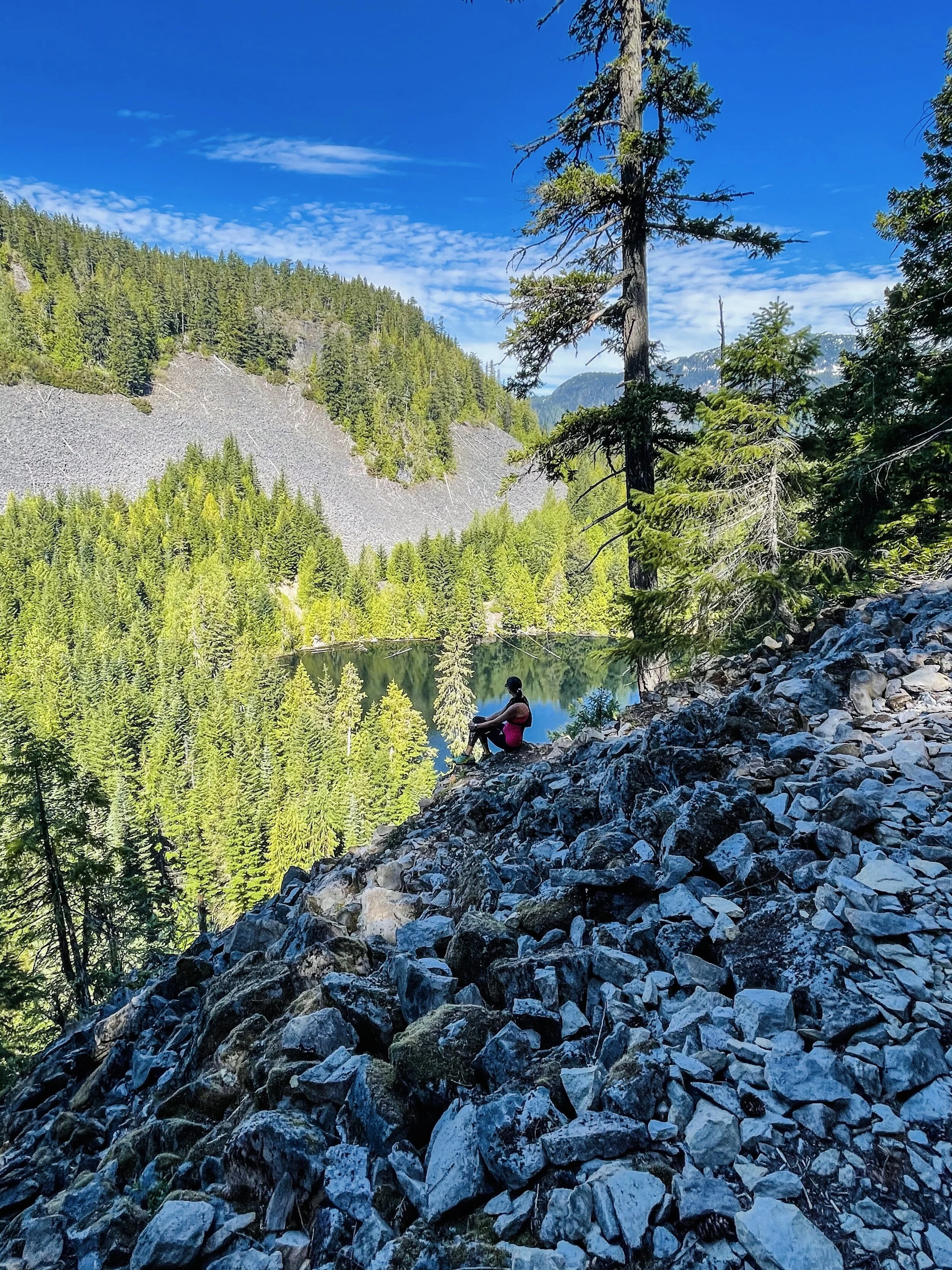
Loggers Lake & Crater Rim (short)
5 km | 270 m | 1.5 hours
Begin your hike from the Loggers Lake parking lot along Cheakamus Lake Road. This lot is small and fills up quickly, especially on a hot summer day. It’s a good option if you are pressed for time, but would like to go up to Crater Rim, feel that burn and see the views. Quick yet satisfying workout.

Loggers Lake & Crater Rim (long)
7.5 km | 370 m | 2 hours
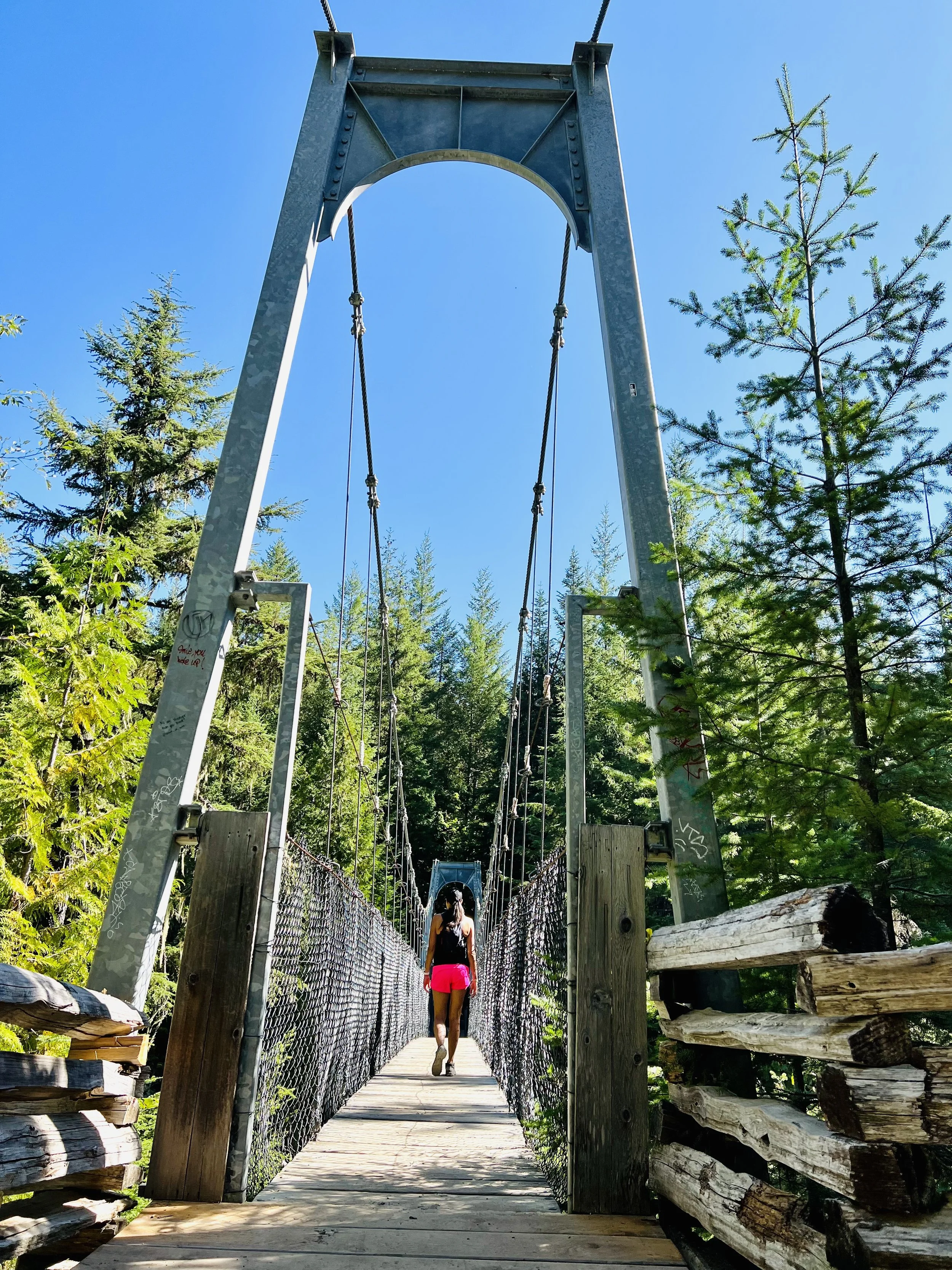
From the Top of Cloudburst Drive start on the Lower Ridge Trail up to towards Loggers Lake. Keep an eye out for the Crater Rim junction on your right as it is easy to miss. The hike over the ridge is incredible. Views of the valley with snow covered peaks in the distance every way you look. The trail is well marked and it will loop you around and back down to Loggers Lake. From here you have a choice - go left and head back via Lower Ridge Trail or right and head towards Riverside Trail, which begins at the Loggers Lake Parking lot. Both options will give you similar distance to return to the trail head. We like to make our hikes a full loop so we tend to take Riverside Trail back . This option will also allow you to pass by the Suspension Bridge, which is always a great view point. Stay on Riverside Trail until you get to another small parking lot along Cheakamus Lake Road. Cross the road and there will be a short trail that will connect you back to Lower Ridge Trail and where you started.

Farside, Riverside, Loggers Lake & Crater Rim
11 km | 415 m | 2.5 hours
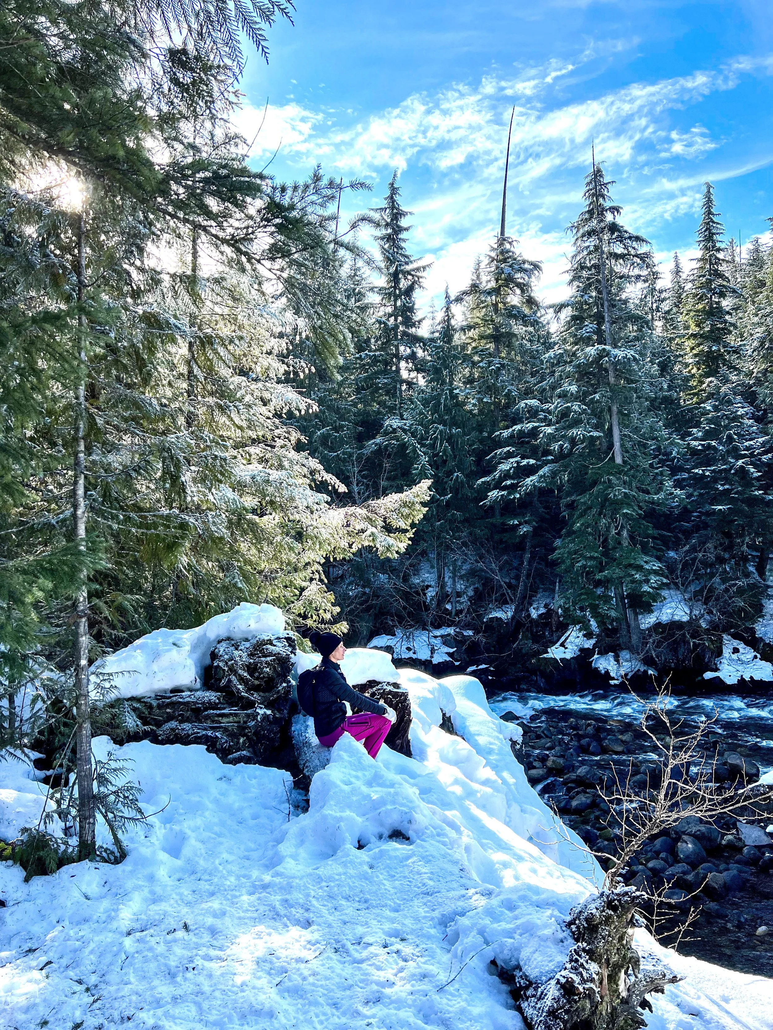
For the long option, we park in the main Whistler Interpretive Forest lot right off HWY 99. Riverside Trail will connect you to Farside Trail which will take you along the Cheakamus River over to the Suspension Bridge. From here you cross the bridge and take Riverside Trail up to Loggers Lake. With this loop we do Crater Rim backwards going up above the Lake first then back down to the Lower Ridge Trail. The connector will bring you back across Cheakamus Lake Road onto Riverside Trail. Hang a left and make your way back to your car.
Here are the directions by Alltrails, but it’s not quite accurate. There’s construction in the area and the parking lot that Alltrails indicates as the starting point is not open. See comments above to adjust your route.

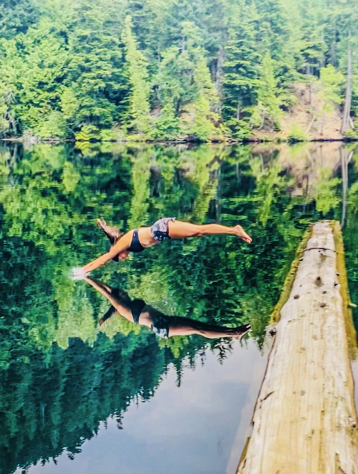
Loggers Lake Swim
Heading up to Loggers Lake for a swim on a hot summers day with your family is the perfect afternoon activity. We like to go to the opposite side of the lake from where everyone usually is. The sun will shine on this side earlier and it tends to be a lot more quiet. There is a spot to lay out your blanket and picnic and you still get a log to walk in on. The water is nice and warm so jump on in!

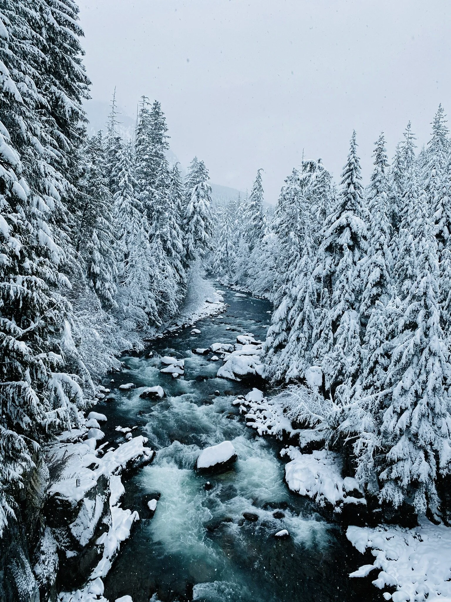
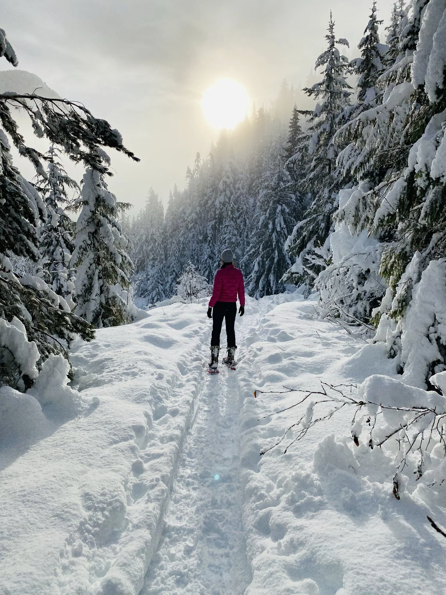
Farside & Riverside Snowshoe
6.4 km | 135 m | 1.5 hours
Most people tend to snowshoe around lost lake where the trails are marked. We always prefer to go off the beaten path and look for areas that are less busy and more scenic. Not to mention FREE! Why would you pay for snowshoeing when you can come here and be provided with these incredible views.
We start in the main interpretive forest lot by the Hwy and do the Farside and Riverside loops. If there is too much snow you can use the Cheakamus Lake Road on one side and the Cheakamus Forest Service Road on the other and cross at the suspension bridge.